Working Groups (WG)
The Working Groups are teams comprised of representatives from SL-NSDI member entities who share a common interest in the issue under address. Each Group focuses on issues that pertain to coordination and the standards associated with the topical area or geospatial data theme (FGDS) such as; data collection, maintenance, access, exchange, and applications using those data.
A Working Group may be initiated for several reasons for example; in response to the needs of a newly engaged entity; a new project track, the development of a new application/e-service; or in response to a specific topic of interest brought to light by the Community through a Special Interest Group (SIG).
The Working Groups function from defined objectives and a working Charter; they are intended for cross-sector collaboration for the delivery of agreed outcomes within a specified timeframe.
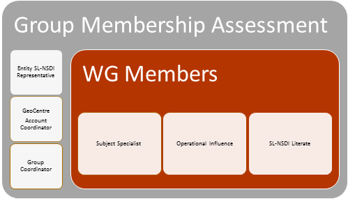
WG Member Selection. Working Groups are formulated to address specific issue in a specified timeframe. The Working Group members are expected to be; subject-matter specialists, able to easily converse with other entity representatives on all subject related issues; from a level within their organizations where they are able to influence, or deliver operational initiatives; and, are knowledgeable regarding the SL-NSDI Program and it’s implementation.
WG Responsibilities. The Group responsibilities include, but are not limited to, the following;
• GeoCentre to assign an Account Coordinator who will be responsible to help facilitate the formation and activities of a Working Group.
• Affected entities to assign one or more representatives to participate in a Working Group.
• One Working Group member to be assigned as Group Coordinator.
• Assist in the development and adoption of common standards of content, format, and accuracy for Working Group-specific data for use by stakeholder agencies and to encourage use by other agencies and organizations, to increase its interoperability and enhance its potential for multiple uses.
• Focus on issues that pertain to coordination and standards associated with a geospatial data theme (FGDS) with regard to data collection, access, exchange, and applications using those data or other areas of interest by the community.
• Participation in the development and evaluation of metadata definitions and other standards used by the international community (ie. International Standards Organisation (ISO), Open Geospatial Consortium (OGC), United Nations (UN) U.S. Federal Geospatial Data Committee (FGDC), EU INSPIRE, etc.) and recommendations for their inclusion in the Sri Lanka Metadata Content Standard as appropriate.
• Assist the development and adoption of common standards of content, format and accuracy for Mstakeh use by all SL-NSDI members, encourage standards implementation by non-SL-NSDI organizations and support interoperability to enhance data’s potential for re-use.
• Facilitate collection and compilation of information for Working Group-specific data activities.
• Facilitate the economic and efficient application of Working Group-specific data through the sharing of experiences involving applications.
• Participate in the development and evaluation of data definitions and standards used by international organizations and standards bodies, and make recommendations for their inclusion in Working Group-specific data as appropriate. Facilitate the collection and compilation of information for entities activities including training opportunities supported by SL-NSDI members and other supporters of the SL-NSDI .